Category: Uncategorized
-
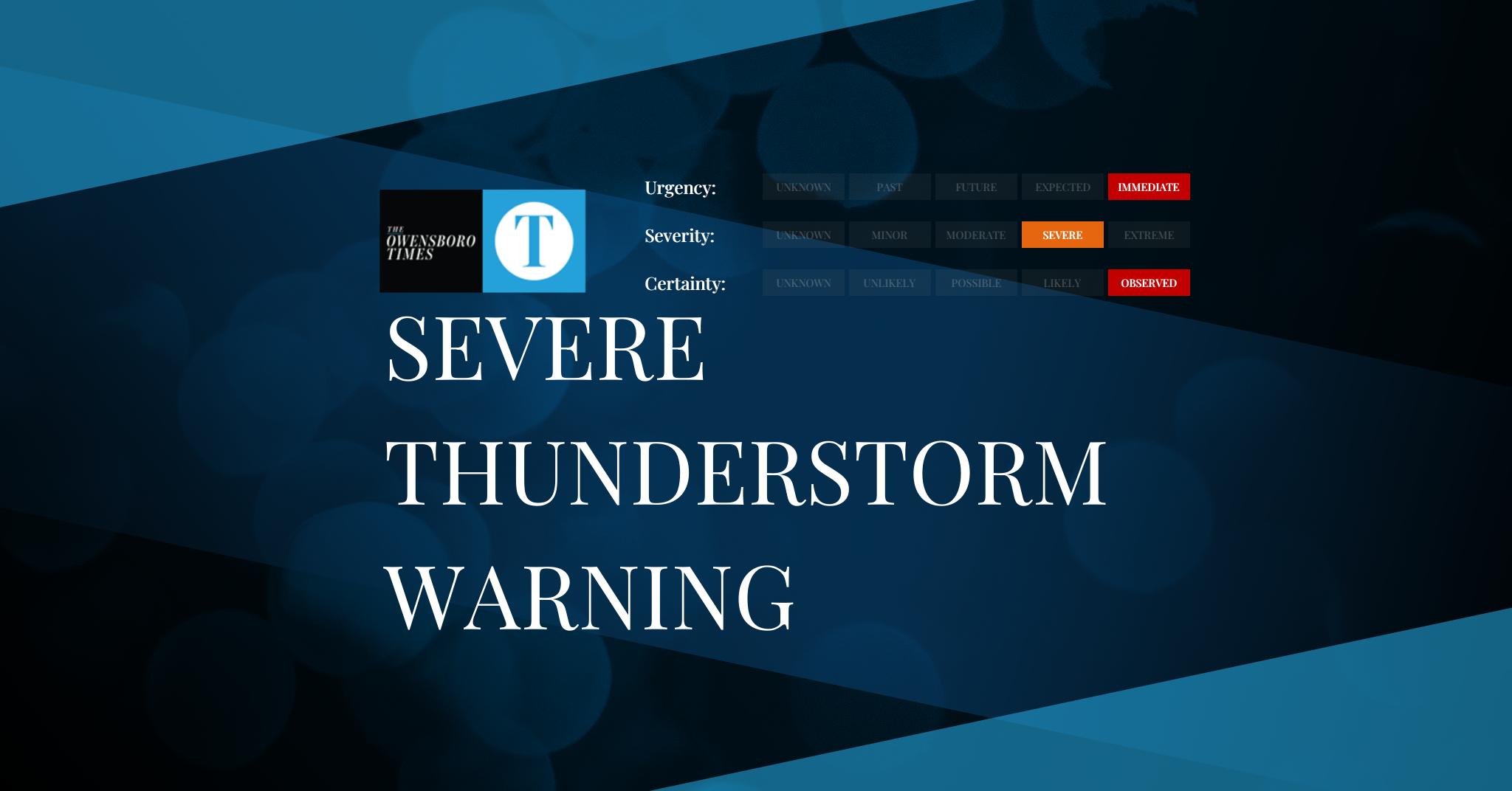
Severe Thunderstorm Warning
FROM: NWS Los Angeles/Oxnard CA AREA: San Luis Obispo, CA SENT: 2026-02-16T06:36:00-08:00 Severe Thunderstorm Warning issued February 16 at 6:36AM PST until February 16 at 7:00AM PST by NWS Los Angeles/Oxnard CA SVRLOX The National Weather Service in OXNARD has issued a * Severe Thunderstorm Warning for… Northwestern San Luis Obispo County in southwestern California……
-

Dense Fog Advisory
FROM: NWS Paducah KY AREA: Jefferson; Wayne; Edwards; Perry; Franklin; Hamilton; White; Williamson; Saline; Perry; Bollinger; Wayne; Carter; Ripley; Butler SENT: 2026-02-16T08:34:00-06:00 Dense Fog Advisory issued February 16 at 8:34AM CST until February 16 at 9:00AM CST by NWS Paducah KY Alert Expiration: 2026-02-16T09:45:00-06:00
-

Dense Fog Advisory
FROM: NWS Paducah KY AREA: Wabash; Jackson; Gallatin; Union; Johnson; Pope; Hardin; Alexander; Pulaski; Massac; Gibson; Pike; Posey; Vanderburgh; Warrick; Spencer; Fulton; Hickman; Carlisle; Ballard; McCracken; Graves; Livingston; Marshall; Calloway; Crittenden; Lyon; Trigg; Caldwell; Union; Webster; Hopkins; Christian; Henderson; Daviess; McLean; Muhlenberg; Todd; Cape Girardeau; Stoddard; Scott; Mississippi; New Madrid SENT: 2026-02-16T08:34:00-06:00 Dense Fog Advisory…
-

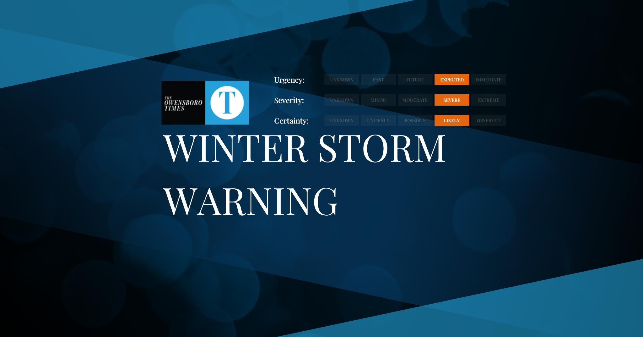
Winter Storm Warning
FROM: NWS Reno NV AREA: Lassen-Eastern Plumas-Eastern Sierra Counties SENT: 2026-02-16T06:33:00-08:00 Winter Storm Warning issued February 16 at 6:33AM PST until February 18 at 10:00PM PST by NWS Reno NV * WHAT…Heavy snow. Snow accumulations 6 to 12 inches west of Highway 395, with local high elevation totals west of Highway 89 up to 2…
-

Winter Storm Warning
FROM: NWS Reno NV AREA: Greater Lake Tahoe Area; Greater Lake Tahoe Area SENT: 2026-02-16T06:33:00-08:00 Winter Storm Warning issued February 16 at 6:33AM PST until February 18 at 10:00PM PST by NWS Reno NV * WHAT…Heavy snow. Snow accumulations between 2 to 3 feet in the Tahoe Basin, highest on the west shore, and much…
-

Winter Storm Warning
FROM: NWS Reno NV AREA: Mono SENT: 2026-02-16T06:33:00-08:00 Winter Storm Warning issued February 16 at 6:33AM PST until February 18 at 10:00PM PST by NWS Reno NV * WHAT…Heavy snow. Snow accumulations between 1 to 3 feet along and west of US-395. Accumulations of 3 to 5 feet in the highest elevations along the Sierra…
-
Winter Storm Warning
FROM: NWS Reno NV AREA: Greater Reno-Carson City-Minden Area SENT: 2026-02-16T06:33:00-08:00 Winter Storm Warning issued February 16 at 6:33AM PST until February 18 at 4:00AM PST by NWS Reno NV * WHAT…Heavy snow. Snow accumulations between 4 and 8 inches on the valley floor with 8 to 16 inches for foothill areas above 5000 feet.…
-

Red Flag Warning
FROM: NWS Pueblo CO AREA: Northern El Paso County Including Monument and Black Forest; Southern El Paso County Including Fort Carson and Colorado Springs; Pueblo County Including Pueblo; Huerfano County Including Walsenburg; Western Las Animas County Including Trinidad and Thatcher SENT: 2026-02-16T07:29:00-07:00 Red Flag Warning issued February 16 at 7:29AM MST until February 17 at…
-

Red Flag Warning
FROM: NWS Pueblo CO AREA: Teller County/Rampart Range Including Pikes Peak and Florissant Fossil Beds National Monument; Fremont County Including Canon City/Howard/Texas Creek SENT: 2026-02-16T07:29:00-07:00 Red Flag Warning issued February 16 at 7:29AM MST until February 16 at 6:00PM MST by NWS Pueblo CO * AFFECTED AREA…Fire Weather Zones 221 and 222. * WINDS…Southwest 10…
-

Red Flag Warning
FROM: NWS Pueblo CO AREA: Northern El Paso County Including Monument and Black Forest; Southern El Paso County Including Fort Carson and Colorado Springs; Pueblo County Including Pueblo; Huerfano County Including Walsenburg; Western Las Animas County Including Trinidad and Thatcher SENT: 2026-02-16T07:29:00-07:00 Red Flag Warning issued February 16 at 7:29AM MST until February 16 at…